Hello everyone, this is just a quick note that we (i.e. Matt Cooke and Ricky Ma, with assistance from Brie Dungate) have released a new updated version of Pathfinder. The major changes are 1) the ability to import an increased number of types from various softwares, and 2) a window that shows you a visualization of your current parameters.
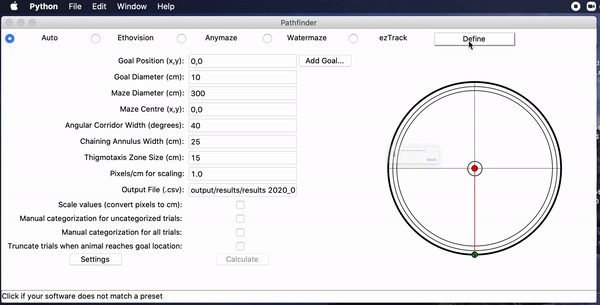
Since the original release we have gotten queries from a number of folks whose .csv or .xlsx files weren’t read by Pathfinder, because the x, y or time coordinates weren’t in the expected places. Most of the time this was because people wanted to use Pathfinder to analyze data from non-rodent or non-water maze experiments that used unsupported software, such as studies of human virtual navigation. To address this we added a “define” button, which pulls up a new window where you can tell Pathfinder where the X, Y, and T information is. See the gif below:
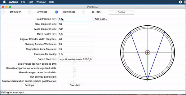
The other feature we added is a live preview of your parameter settings, things like maze size, thigmotaxic zone etc. As you change these parameters you will see an updated live preview. We thought this would help people get their settings in the right ballpark, and provide some intuitive feedback about what is being measured.
More details can be found on the Pathfinder Github page.